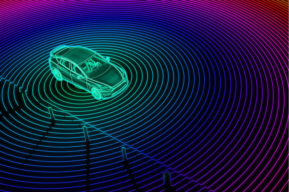
Unlock the power of Lidar data with our expert annotators. We provide meticulous 3D point cloud labeling, enhancing autonomy in vehicles, robotics, and geospatial applications.
Discover the POWER of our Data Annotation Services !
Fill out the form below to schedule a personalized demo and see how we can transform your business.
Defining Lidar Annotation
Unlock Lidar precision with our annotation services. Our experts meticulously label 3D point cloud data, ensuring accurate object identification for autonomous vehicles, robotics, and geospatial applications.
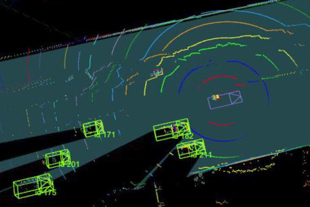
Where is Lidar Annotation Commonly Applied?
Automotive: Optimize autonomous vehicle perception by annotating Lidar data for object detection and recognition, ensuring safe navigation.
Robotics: Enable robots to navigate and interact with their environment effectively through precise Lidar annotation for object detection and mapping.
Geospatial: Contribute to accurate geospatial mapping and environmental monitoring by annotating Lidar point clouds for enhanced data interpretation.
Urban Planning: Support urban planners in analyzing Lidar data for infrastructure development, land-use planning, and environmental impact assessment.
Advantages & Disadvantages:
Advantages:
High Precision 3D Annotations:
Lidar annotation provides high-precision 3D annotations, contributing to accurate object identification and mapping.
Enhanced Autonomous Systems:
Contributes to the development of robust autonomous systems, such as self-driving cars and drones, by improving object detection capabilities.
Disadvantages:
Time-Intensive Process:
Lidar annotation can be time-intensive, requiring meticulous attention to detail for the accurate labeling of 3D point cloud data.
Specialized Skill Requirement:
Annotating Lidar data demands specialized skills, and training annotators for this task may pose a challenge.
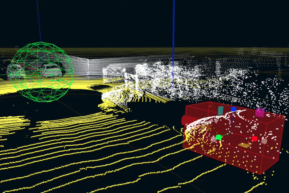
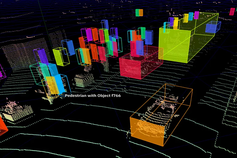
Lidar Annotation Guidelines
Optimal Point Cloud Annotation:
Achieve optimal Lidar point cloud annotation by ensuring precise labeling of objects in 3D space, contributing to accurate environmental mapping.
Consistency in Object Classification:
Maintain consistency in object classification across Lidar datasets, ensuring uniformity in the labeling process for improved model training.
Utilize 3D Visualization Tools:
Enhance Lidar annotation accuracy by utilizing 3D visualization tools, providing annotators with a comprehensive understanding of spatial relationships in the data.
Trusted Annotation Platforms
How Subul Data Annotation Works For You
Personalized and Fully Managed
Get a dedicated project manager to handle everything from guidelines to quality control, ensuring a seamless experience from start to finish.
Multilayer Quality Control
Experience the assurance of multi-tiered QC processes, including peer review and expert checks, guaranteeing a minimum accuracy of 98%.
Diverse and Scalable Workforce
Access a diverse team of industry experts, assembled within 72 hours, tailored to fit your project's specific needs and scale.
Unbiased and Compliant
Rely on our rigorously trained workforce for unbiased data, perfectly aligned with international privacy and AI standards.
Express Delivery
Benefit from our dynamic workforce, capable of rapidly scaling up to meet tight deadlines and ensure swift project delivery.
Direct Social Impact
Make a difference with every project; our entire workforce comes from refugee and disadvantaged backgrounds, contributing to social goals.