Unlocking the Power of Aerial Image Annotation: Transforming Data into Insights
In today’s data-driven world, aerial image annotation stands at the forefront of technological advancements, enabling businesses and researchers to unlock valuable insights from aerial imagery.
Whether you’re in agriculture, urban planning, environmental monitoring, or any other industry that relies on aerial data, precise and accurate image annotation is critical for extracting meaningful information.
What is Aerial Image Annotation?

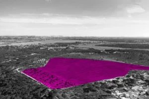
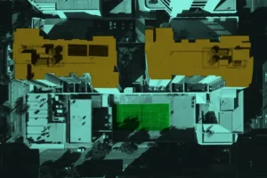
Aerial image annotation involves the meticulous process of labeling objects, features, and regions in images captured from aerial platforms such as drones, satellites, and aircraft. These annotations are essential for training machine learning models, facilitating accurate image analysis, and driving decision-making processes across various sectors. By identifying and categorizing elements like buildings, roads, vegetation, and water bodies, aerial image annotation transforms raw imagery into actionable data.
The Importance of Aerial Image Annotation

- Enhanced Accuracy in Machine Learning Models: For machine learning models to perform effectively, they require high-quality, annotated datasets. Aerial image annotation provides the labeled data necessary for training models to detect and recognize patterns, objects, and changes in the environment.
- Improved Decision Making: Accurate annotation allows organizations to make informed decisions based on detailed analysis. For instance, in agriculture, annotated aerial images can help monitor crop health, identify pest infestations, and optimize irrigation strategies.
- Urban Planning and Development: Urban planners use annotated aerial images to map out infrastructure, monitor construction progress, and plan new developments. This ensures sustainable growth and efficient use of resources.
- Environmental Monitoring: Annotated images are crucial for tracking environmental changes, such as deforestation, glacier melting, and natural disasters. This information aids in conservation efforts and disaster management.
Industries Taking Flight with Aerial Image Annotation
The applications of aerial image annotation extend far beyond the examples listed above. Here’s a glimpse into how various industries are leveraging its power:
- Agriculture: Optimize crop yields, assess crop health, and detect pests or diseases at an early stage through precise field segmentation and plant identification.
- Construction: Monitor construction progress, track material inventory, and identify potential safety hazards with real-time drone imagery and object recognition.
- Insurance: Automate damage assessment after natural disasters by pinpointing affected buildings, flooded areas, or downed power lines through accurate object detection and classification.
Why Choose Professional Aerial Image Annotation Services?

Manual annotation of aerial images is a time-consuming and labor-intensive task that requires a high level of expertise. Professional services, like those offered by Subul Data Annotation, provide the following benefits:
- Precision and Accuracy: Our team of experts ensures that every annotation is meticulously labeled, reducing the risk of errors and improving the quality of your data. We use advanced tools and techniques to deliver precise annotations that meet the highest standards.
- Scalability: We handle large volumes of images efficiently, allowing your projects to scale without compromising on quality. Our services are designed to support both small-scale and large-scale annotation projects.
- Advanced Tools and Techniques: Utilizing the latest technology, we deliver annotations that meet the highest standards. Our team is proficient in using state-of-the-art software and methodologies to ensure accuracy and efficiency.
- Custom Solutions: We tailor our services to meet your specific needs, ensuring that the annotated data aligns perfectly with your objectives. Whether you need annotations for a specific project or ongoing support, we provide flexible solutions that fit your requirements.
The Process of Aerial Image Annotation at Subul Data Annotation

At Subul Data Annotation, we follow a systematic approach to ensure the highest quality of aerial image annotation:
- Initial Consultation: We start with a detailed discussion to understand your project requirements and objectives. This helps us tailor our services to meet your specific needs.
- Data Collection and Preparation: We gather and prepare the aerial images for annotation, ensuring they are in the correct format and quality.
- Annotation: Our team of experts meticulously labels the images, using advanced tools and techniques to ensure precision and accuracy.
- Quality Assurance: We perform rigorous quality checks to ensure that the annotations meet the highest standards. Any errors or inconsistencies are promptly addressed.
- Delivery and Support: We deliver the annotated images in your preferred format and provide ongoing support to address any questions or concerns.
Case Studies: Real-World Applications of Our Aerial Image Annotation Services
Agriculture: A leading agricultural firm used our annotation services to monitor crop health across vast farmlands. By analyzing annotated aerial images, they were able to identify areas affected by pests and diseases, enabling timely interventions that improved crop yields and reduced losses.
Urban Planning: A city planning department utilized our services to map out new infrastructure projects. The annotated images helped them visualize the impact of proposed developments on existing structures and plan accordingly, ensuring efficient use of resources and sustainable growth.
Disaster Management: During a recent natural disaster, emergency response teams relied on our annotated images to assess damage and plan recovery efforts. The accurate data provided critical information for resource allocation and helped prioritize areas needing immediate assistance.
Transform Your Aerial Data Today
At Subul Data Annotation, we are dedicated to providing top-notch aerial image annotation services that help you turn vast amounts of aerial imagery into actionable insights. Our expert team, cutting-edge technology, and commitment to excellence make us the ideal partner for all your annotation needs.
Ready to enhance your data accuracy and drive better decision-making? Contact us today to learn more about our aerial image annotation services and discover how we can support your projects.
Contact Us
For inquiries and service details, visit our website at Subul Data Annotation or reach out to our customer support team. Let’s work together to unlock the full potential of your aerial data.